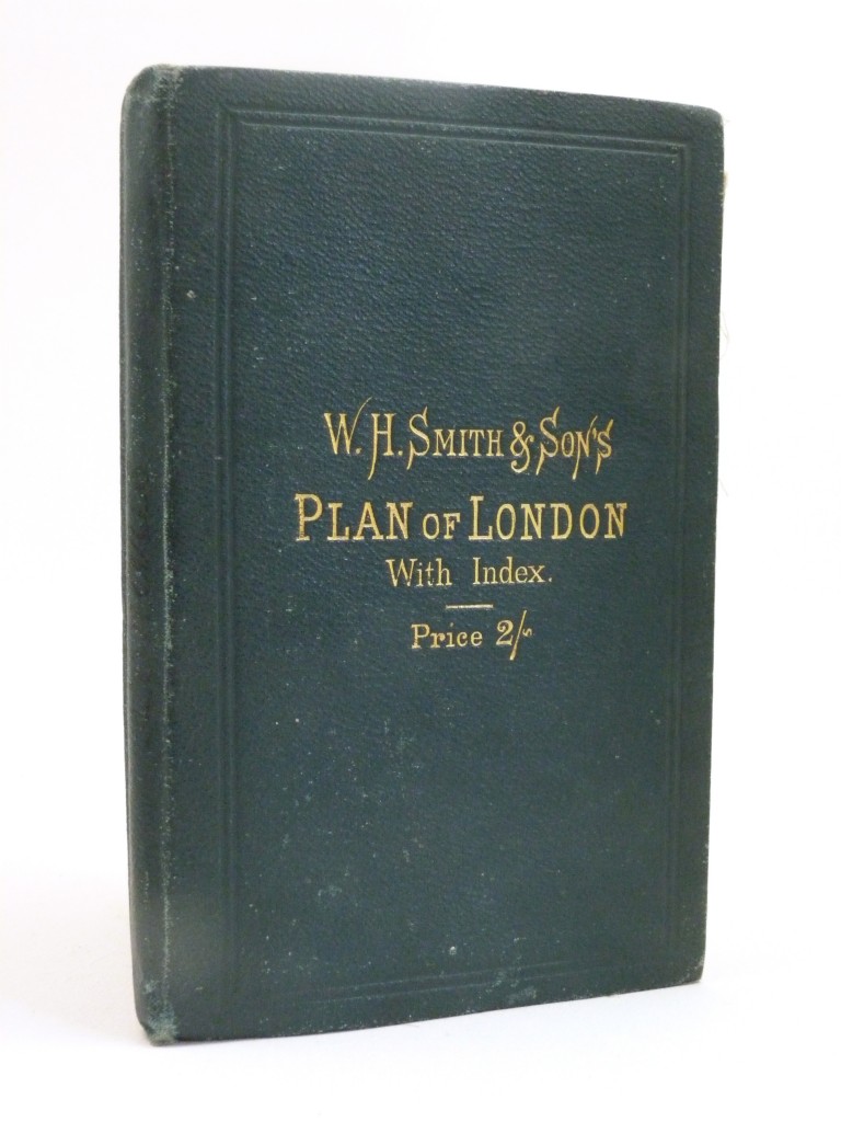
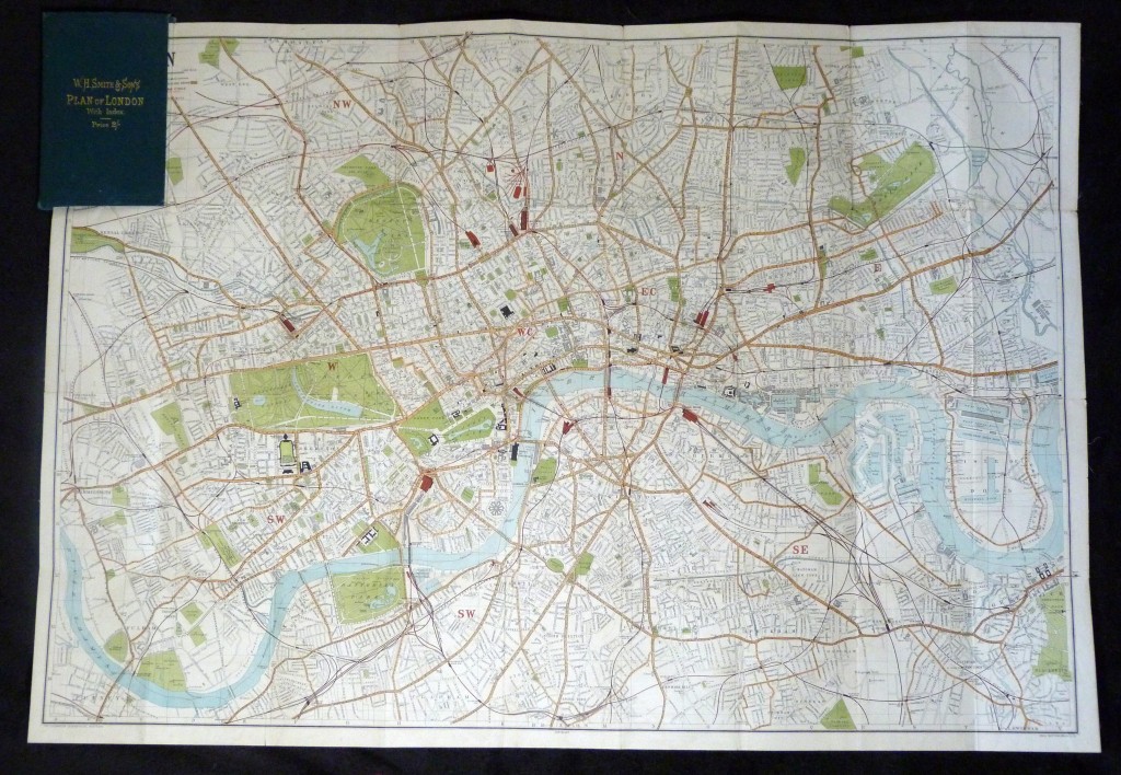
W. H. Smith's & Son's Plan of London with Index, c1875
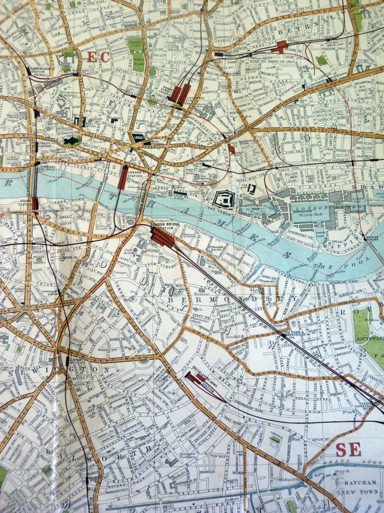
A large fold-out coloured map of Victorian London
Author
Publisher
Printing Details
Green cloth boards, with gilt titling to front. Folded: 16 × 10cm, unfolded: approx 59 × 83cm.
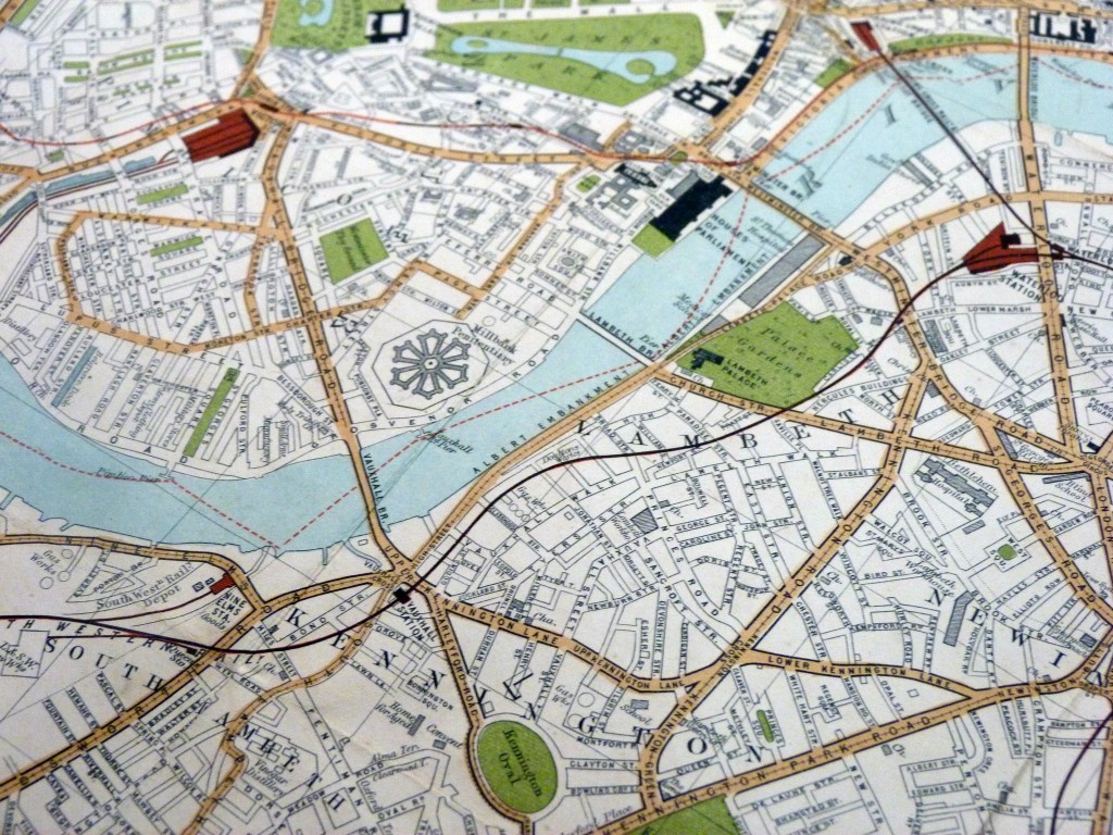
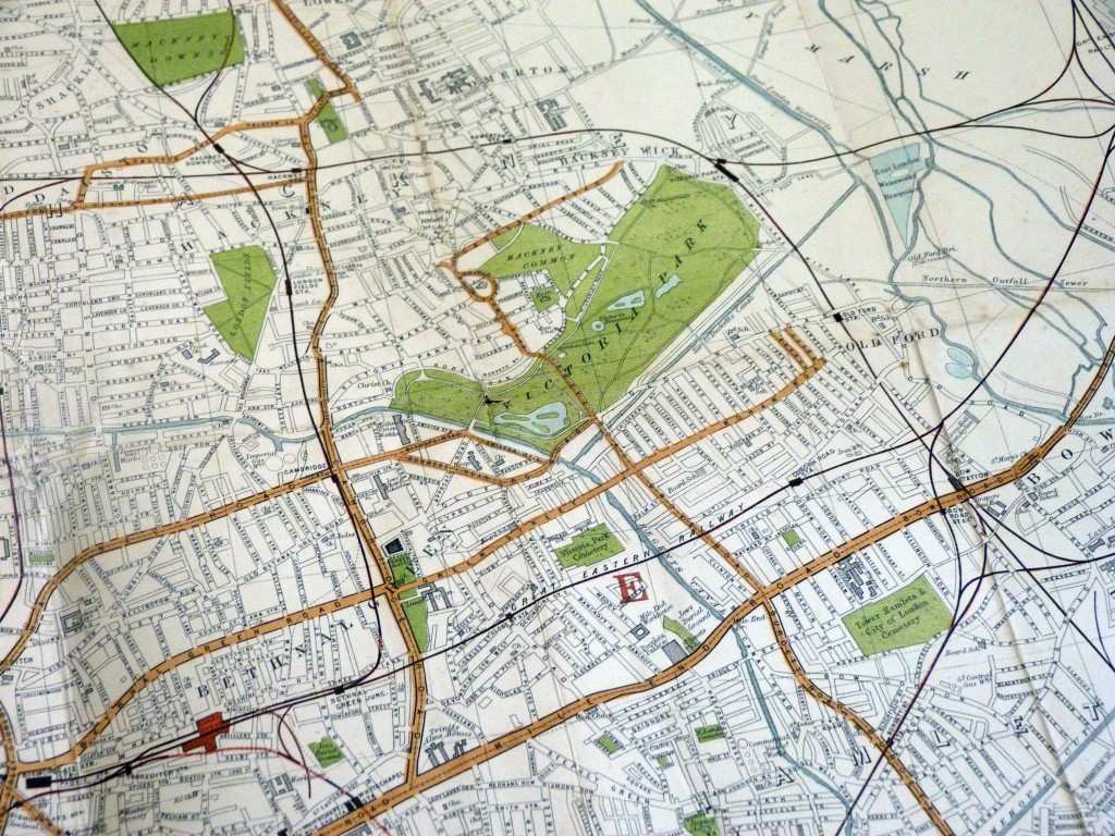
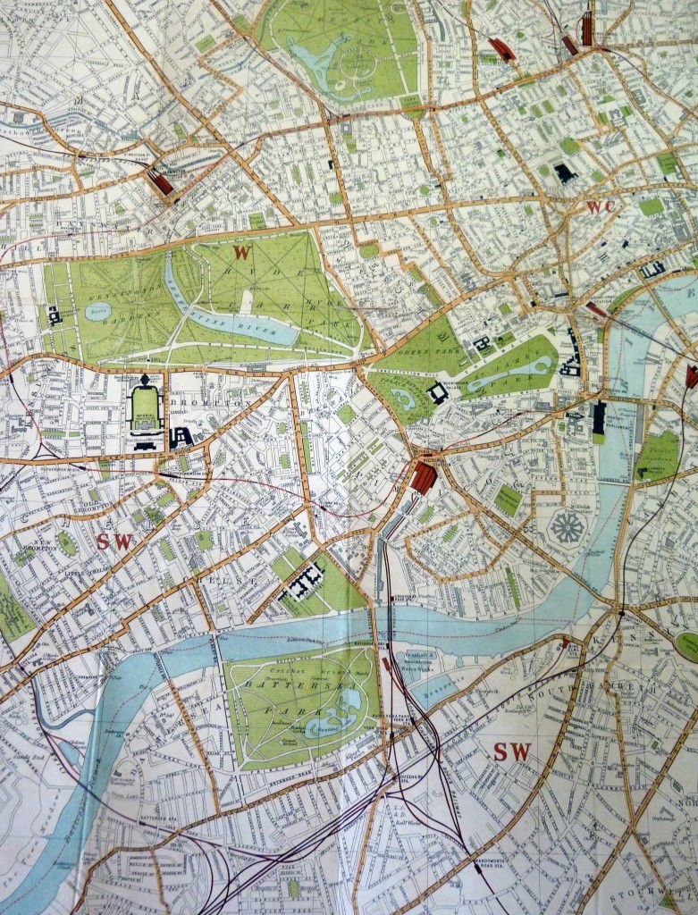
An attractive Victorian plan of London, mounted on linen and drwan by John Bartholomew. The date is approximately the mid-1870s to the early 1880s as Millbank Penitentiary is still present (it functioned as a prison until 1890), Tower Bridge has yet to be built (1886), there is no Aldwych or Kingsway (early 20th century) but Victoria Embankment has been built (1870). The street map shows London before the slum clearances and, of course the Blitz, and the streets of Jack the Ripper and Sherlock Holmes can be seen. Railway stations are well marked (including the now defunct Bricklayer's Arms station off the Old Kent Road), as are parks, hospitals, churches etc. A fascinating map.
Condition
Good plus condition for age. The green cloth board are rubbed and a little frayed to the edges, and the paper covering of the inside spine is torn (this doesn't weaken the binding). The map is clean and folds well, but there are some small areas of wear and holing where the horizontal and vertical folds meet.
On Hold