Scarce 1913 British Army map for training trenches in Kent
The Defence of Beaux Air, an area of Kent, with map, logistics and engineering
Author
Publisher
Printing Details
This is complete tactical engineering scheme for a defensive position, created just over a year before the outbreak of World War I. It describes the work needed to create a defence of Beaux Air Farm (and the surrounding Beaux Air Wood), an area south east of Chatham and used by the military for training purposes. An interesting document
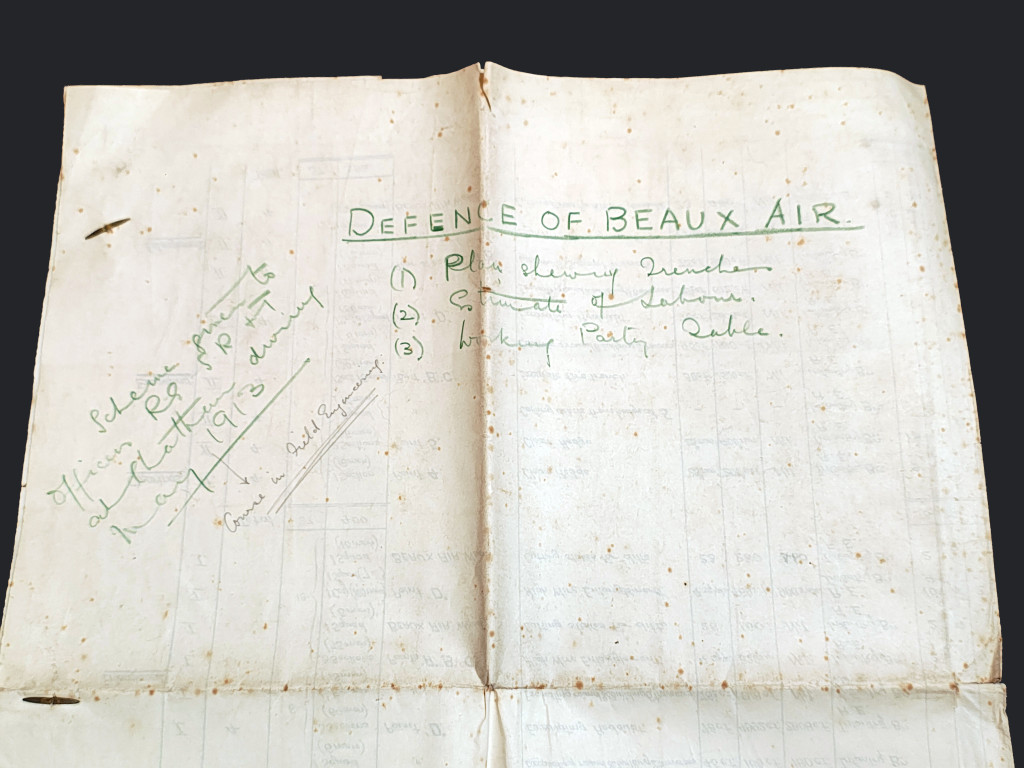
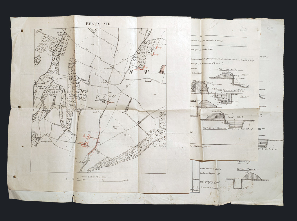
It is formed of three sheets, the largest being 75 × 50cm, the smallest being 50 × 48cm, and they are pinned together to the left hand side. On the reverse is written "Defence of Beaux Air", and "Scheme given to Officers RG & SR + T at Chatham during May 1913". The sheets show:
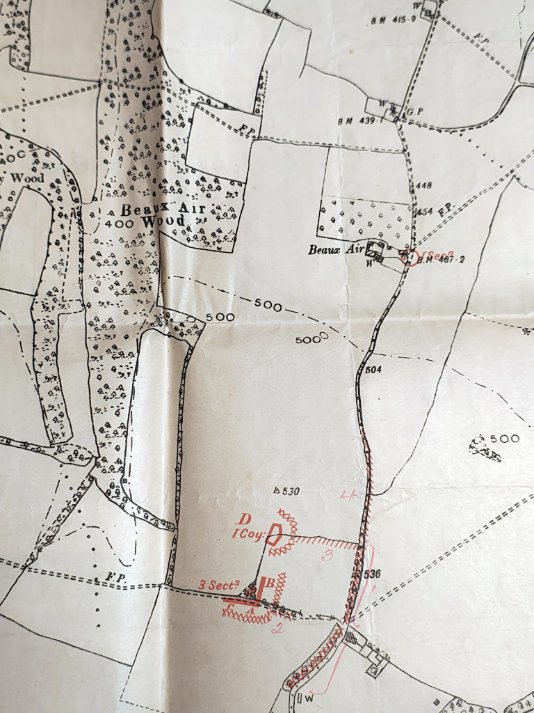
The Plan (Map 1): Shows the layout of the Redoubt (a self-contained fort) and the fire trenches, with red ink indicating the proposed defensive works, such as where the wire entanglements go and where the infantry would be positioned.
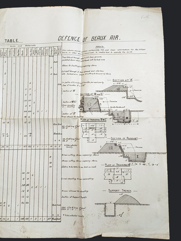
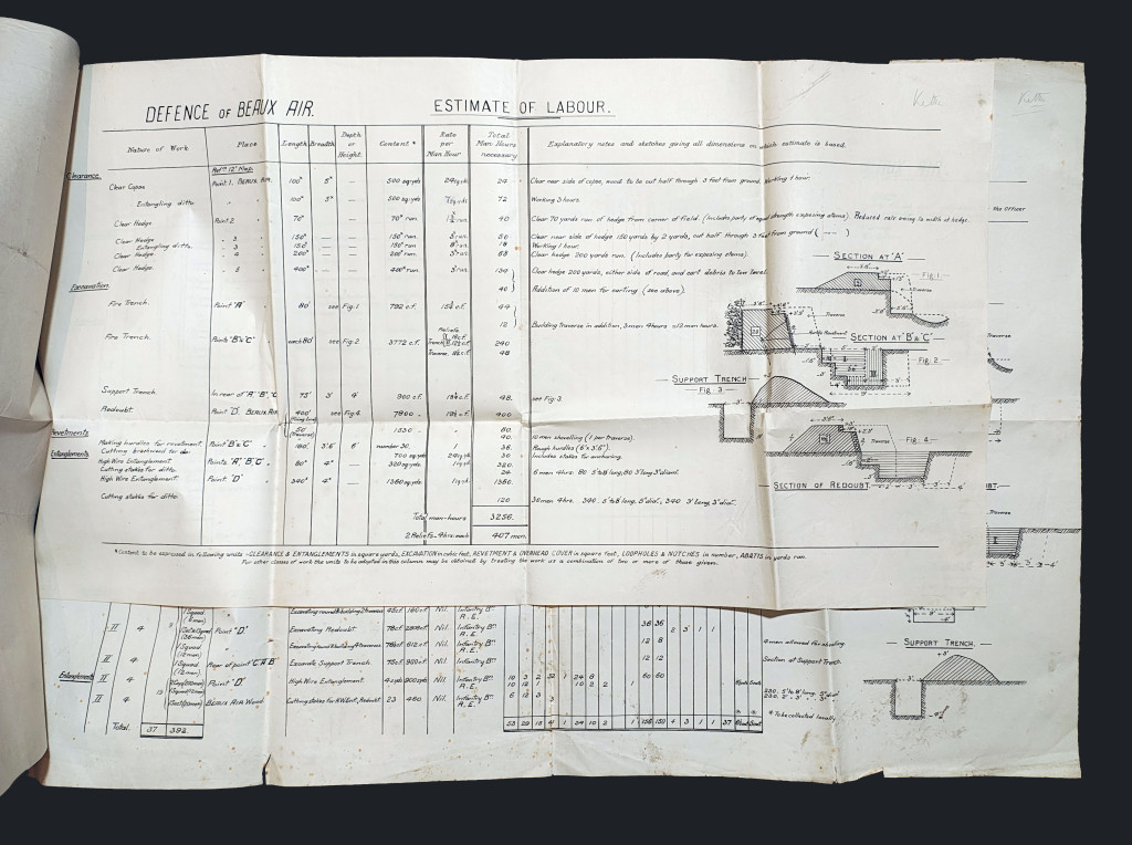
Estimate of Labour (Map 2): This is a technical spreadsheet. It calculates the man-hours required to dig the trenches. It includes cross-section diagrams of fire trenches and support trenches, showing exactly how deep and wide they must be to protect a soldier from shrapnel.
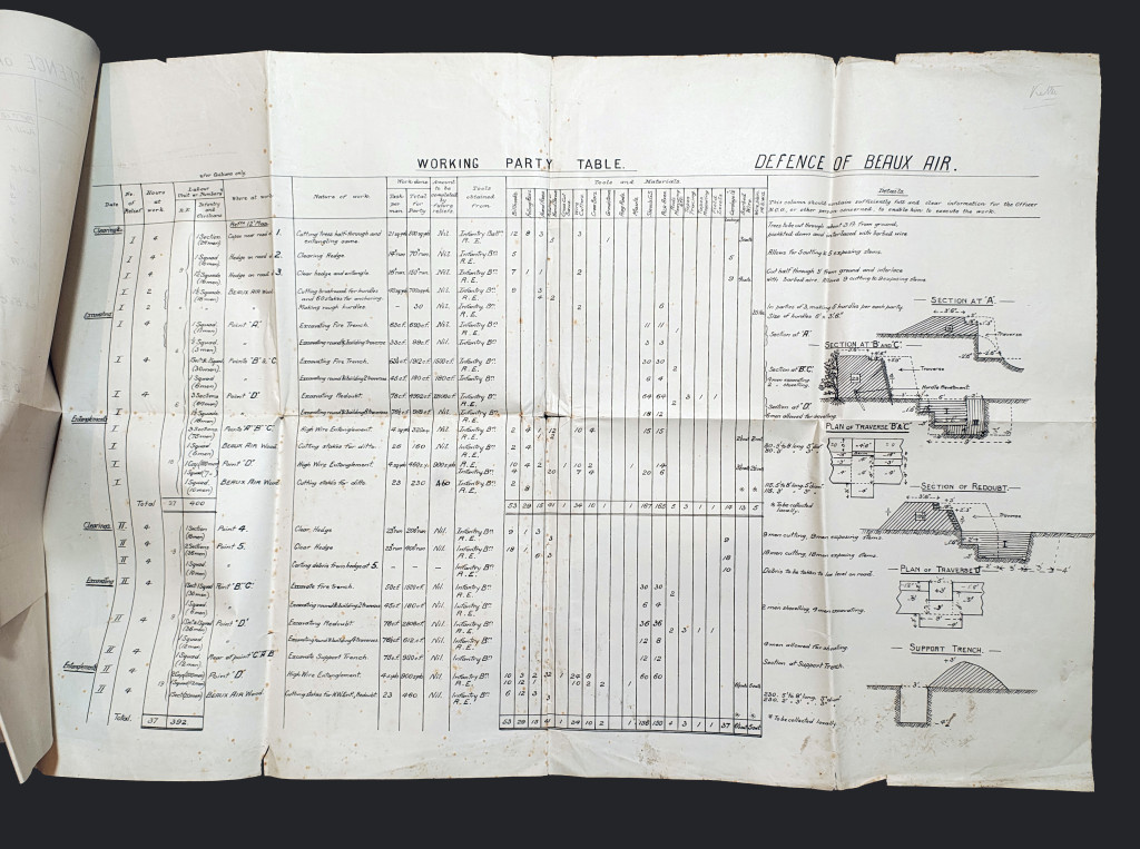
Working Party Table (Map 3): This is the logistical execution plan. It lists how many men (Infantry and Royal Engineers), what tools (picks, shovels, billhooks, wire cutters), and what materials (sandbags, barbed wire) are needed to complete the work in a 4-hour "relief" (shift).
Condition
Good condition for age, but with some spotted foxing to the reverse and small tears to the folds and creases. However, it appears complete and perfectly decipherable.
Books are currently zero-rated for duty (as of January 2026), so the price shown is the price you pay.
Price
£50.00